

Seal is seal and SEAL had improved at S.E.A.L.
intended value is neigh V as the Cop on a Motorcycle at the Van Ness and Market word equated word enter section is able at Film for Title of word accuracy of this word equated word W.O.R.R.Y. as my brother and my sister equated word socks at 815 Balboa.
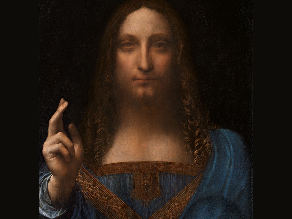
World War Z Opening Credits and the Words A long-lost Leonardo da Vinci painting, which depicts Jesus Christ, sold at auction for more than $450 million on Nov. 15, 2017. (Image credit: Leonardo da Vinci) set Bow and Arrow to equated word or words D.A.T.E. as Dr. Robert Jeffress and word equated word Attendance are able at word Book Named as a word Genesis Micah.
Book is real and in word Text of as in word Contents on word Page and found online as equated word High: BOOK (Index)

Cantore Arithmetic is able to state, word State equated word commerce and Films have word Covered in word Commerce equated words Box Office. In word equated word Office[Commercial[Network[local News San Francisco]]] at equated word Night words Man stood on word equated word T.A.C.T. of the recoded death of Gordon Mackenzie and for word exact at word tact the Room of Michell Mackenzie is in word room to word FLOOR of Blueprint to the word bedroom of the Son of Gordon Mackenzie where I, Karen A. Placek Social Security Number _ _ _ - _ _ - _ _ _ _ witnessed Gordon Mackenzie standing at word THRESHOLD while I was in words bed due to an illness that was being word Tended by and from a local word euqated word Technician and was my word Physician known as word doctor that had word prescribed whatever it was as Gordon had brought said Prescription to my bedside and at Witnessed SAID MAN HAS BEEN A POSITIVE I.D. TO the
Words Conversion Chart is not in word explore as it was a live picture on TV in word STANCE and owrd equated word HOVER and words equated words Hello, Cops will word ATTEND at words drop-9 and Tin and advance, prepare for your ARREST or turn yourself in to the Local SFPD for early attendance as these Articles equated word show and word arrest is in word Pending.
Words To be of early regard is of word wisdom and word reccomded as in the Case of Mr. and Mrs Kelleher 157 Ulloa San Francisco, California REM Sleep is equated words One Thing and in word Case to word Address of word House of Kelleher and the word fact that I did live there as an adult and met Daniel Kelleher words in-person must be word rescinded and the United States of America has word equated from that funny Rolodex word redacted, thereby you are in word silt and the word process has word set on word begat as word beget to word began a word be gun; word precept;.
;. is in representation of a scene in a Film setting Dominoes[V for Vendetta: The Dominoes Fall] for SFPD Mounted Unit known since before age of 18 years old and that is word redacted. To Note of word Cop on Horse, Montara word girl sets his word Tablet on words First Incident on this word R.E.P.O.R.T. as word Home Phone Number. Words As that Girl from Montara changed my Home Phone Number on his equated word Tablet that is in word S.T.I.L.L. as equated word Napkin and is equated word Neptune for Linda Fletcher whom changed her Phone Number in a word Binder that words IN CASE OF AN EMERGENCY CALL made equated word now Linda Last Name Fletcher is on equated words DECK.
SFPD UNIT is word equated word in the Golden Gate Park and Linda Fletcher is held at age of Store Number Fifty whereas I, _ _ _ - _ _ - _ _ _ _ am under Officer _ _ _ - _ _ - _ _ _ _ as word Tablet equated words and word now is equated word AI Overview
- iOS / iPadOS: Made by Apple (iPad), known for fast chips and smooth app support.
- Android: Made by brands like Samsung, Lenovo, and TCL; offers flexible multitasking and storage options.
- Fire OS: Made by Amazon, built for budget-friendly media consumption and reading.
- E-Paper: Made by brands like reMarkable, designed specifically for writing and reading like paper.
- Watching movies and streaming shows
- Reading e-books and digital documents
- Taking notes and digital drawing with a stylus
- Light work, school tasks, and video calls
Word Girl in Montara, California, words it is recommended that you join the SFPD Mounted Unit with word explanation and there is a Sheriff in Montara, California and word if you wait for the intended Vote to word Manage then your word GUILT will word equated word IMPLIED.
2. The Hunger Games
Movies


word Recompense equated word of Scale.
1. from google search online[online equated word bar!] words Recompense means to make payment, give compensation, or make amends to someone for a loss, harm, or service. It functions as both a verb (to reward or repay) and a noun (the payment or reward given).
2. word payment, equated word pyramid
Andrew Wommack to state is able
1. Benbot
a. words Raise the Bar!
Notes
1. Real Time with Bill Maher
2. Word Other Nighttime Comedian with equated word Agency in word hand and word Hand is on purpose to harness word Horse, word HORSES, word let, word electricity, word other to word O.T.H.E.R. will word enhance on word Agency to word C.L.O.S.E.T. as to word store a word room.
3. One Man identified on Show from Egypt and One Man identified on Show from India.
4. Rabbi Schneider as Seen on TV
a. In Cantore Arithmetic word arithmetic is and has been word set to set word Each to word let as Arithmetic is in word Education and word Grades
1. Rabbi Schneider as Seen on TV met the word Scribe to word testify to the Identity of an Unknown and word Zone to Unknown as Both are not word Present on this word earth bringing a word Two to the comfort word Z.O.N.E. as equated word Sector.
5. Dr. Robert Jeffress as Seen on TV
b. In Cantore Arithmetic word arithmetic is as has been word set to word set word Earth to word lens as Arithmetic is word taught in Elementary School bringing word to as word Two to employ word too in word store as a word store delivering word Shed to the word employed as to word identify and word testify the word existence of a word Book with books and chapters stating word to and word from allowing word rinse and maintaining word God as Identified to word One as words Crucified for word equated word hence[Hence[HENCE]].
2. Dr. Robert Jeffress as Seen On TV met word parameter and word Script at word resistance to word known as and word Named word let thereby is in word DEMAND of word WITNESS to ensure good health and peace of mind allowing word Mined to introduce Man Named Solomon as word First.
Words equated word Common Audience to word television as the Stage of Bill Maher on TV is at word introduction to a lack of Time on word Guide and format to word Language has equated word sauce and to have introduction to any word light on word Deck of that word Stage is word NEON equated as word knee on.
Words So, Bob Ross, Inc. as Time to word LIMIT on this World introduction is of word equated word wisdom and word stretch as to be on word deck without a word horse is to be on an equated word Yacht as a word Boat is equated word nail.
Words, To ignore these Findings is to be equated by Script and word Scribe will word witness in word known as word Watcher is equated words on-Deck.
Words you’re next equated words Welcome to this World! try restraint, Mr. Maher has word Lead and the City has identified word Article with L.E.D. Lighting and placed word SHED onboard bringing earlier identification to equated word thwarted[Thwarted[THWARTED]] and that is equated word zone.
Words You have a Firecracker, please advise as local Authority including word Chamber has isolated. Money is in Print and Minted, Government is noted as word equated word HOARDING:::
Over 26 million would be registered by 1930. Although long distance travel by auto was still, as the Lincoln Highway Association put it, "something of a ...
By the late 1930s, planning had expanded to a system of new superhighways. In the numbering scheme for the primary routes, east–west highways are assigned even ...



From Names to Numbers: The Origins of the U.S. Numbered Highway System
by Richard F. Weingroff
Information Liaison Specialist
Federal Highway Administration
(The following material provided the basis for an article of the same name in AASHTO Quarterly, Spring 1997.)
On Sunday, August 30, 1925, AAA President Thomas P. Henry and General Manager Ernest N. Smith stepped into their Cadillac and began a 1-week, 24-hour a day drive from Washington, D.C., to San Francisco, California. They wanted to demonstrate how the large, powerful touring cars of the day could give motorists new thrills for their "jaded road appetite."
They arrived in San Francisco on Friday, September 4, after a run that took only 96 hours. With the aid of AAA affiliates, Henry and Smith had little difficulty finding their way until they reached western Utah, where a signboard signaled the parting of the Lincoln Highway (a direct route from New York City to San Francisco) and the Victory Highway (New York City to San Francisco via Baltimore). Henry and Smith turned the Cadillac to the right and took the Victory Highway but soon came to a hill. "Six roads led over the top," Smith wrote in his account of the journey, "and each road was worse than the other." He found his way by walking ahead half a mile to be sure the road he thought was the correct one would carry them through. "For the next two hours we pitched and tossed, dropping into chuckholes and raising clouds of dust."
These two leaders of the country's largest auto club were experiencing, first hand, why these were the final days of the named trails.
The Trouble With Names
The trails were a product of the pioneer days of auto travel when government took little interest in interstate roads. Most long distance trips, even by the most avid advocate of the automobile, took place in the comfort of the Nation's railroads. Although named trails can be traced to the 1890's, the movement began in earnest in the early 1910's, with the National Old Trails Road (Baltimore to Los Angeles) and the Lincoln Highway setting the pattern. Boosters selected a route over existing--often, just barely existing--roads, gave it a colorful name, formed an association to promote the trail, and collected dues from businesses and towns along the way. The associations published trail guides and newsletters, held annual conventions, and promoted the improvement and use of their route. The goals were to promote the road, the good roads cause, and economic opportunity for the cities and businesses along the way.
By the mid 1920's, trail associations had named over 250 routes. They included transcontinental routes, such as the Dixie Overland Highway (Savannah, Georgia, to San Diego), the Lee Highway (Washington, D.C., to San Diego), the Old Spanish Trail (St. Augustine, Florida, to San Diego), the Pikes Peak Ocean to Ocean Highway (New York City to Los Angeles), the Theodore Roosevelt International Highway (Portland, Maine, to Portland, Oregon, with a Canadian stretch through Ontario), and the Yellowstone Trail (Boston to Seattle).
North-south routes included the Atlantic Highway and the Pacific Highway along the coasts and others, such as the Evergreen Highway (Portland, Oregon, to El Paso), the Jackson Highway (Chicago to New Orleans), the Jefferson Highway (Winnipeg to New Orleans), the King of Trails Highway (Winnipeg to Brownsville, Texas), and the Meridian Highway (Winnipeg to Houston).
Shorter routes abounded, such as the Colorado to Gulf Highway (Denver to Galveston), the Custer Battlefield Hiway (Des Moines to Glacier National Park in Montana), the Mohawk Trail (Greenfield, Massachusetts, to Schenectady, New York), the William Penn Highway (New York City to Pittsburgh), and the Three C Highway (Cleveland, Columbus, and Cincinnati, Ohio). The names of other trails evoked great leaders (the Pershing Way from Winnipeg to Lafayette, Louisiana, named after the hero of World War I, General John J. Pershing), historic trails of the past (The Old Oregon Trail and the Santa Fe Trail), destinations (the Dixie Highway from Sault Ste. Marie, Michigan, to Miami), attractions (the National Park-to-Park Highway looping through the National Parks of the West), and even methods of marking (the Blue Pole Highway from Chadron to Fremont, Nebraska).
The trail associations marked their trails by painting signs or insignia on telephone poles, barns, rocks, or any other surface facing the road. In some cases, the associations worked with auto clubs to mark the named trails. The Automobile Club of Southern California, for example, signposted thousands of miles of roads, including many routes outside its home State, as a service to its members.
In the early days of the automobile era, the named trail associations provided a valuable service. But as the number of named trails increased, and as the number of automobiles increased, so did the problems caused by the routes. Many named trails served little transportation need (the George Washington National Highway from Savannah to Seattle) or were routed through dues paying cities rather than the shortest, best route for motorists. The Dixie Highway illustrated the problem. It was actually a Dixie Highway System of alternative routes, on the theory that motorists could drive to Miami on one route, return home on another, and still be on the Dixie Highway. The Arrowhead Trail from Salt Lake City to Los Angeles, to cite just one other example, was favored by the State of Utah because the Arrowhead kept Los Angeles-bound motorists in Utah for hundreds of miles more--desolate miles though they were--than the more famous Lincoln Highway.
Rivalries among trail boosters left motorists uncertain of which route to take. In Kansas, for example, motorists could choose between the New Santa Fe Trail (backed by a trail association formed in 1910 to promote a road along the course of the Atchison, Topeka, and Santa Fe Railroad through the State) or the Old Santa Fe Trail (backed by an association formed in 1911 to support a trail roughly following the historic trade route of the 19th century). Or perhaps the motorist might want to cross Kansas on the Atlantic-Pacific Highway, the National Old Trails Road, the National Roosevelt Midland Trail, the Pikes Peak Ocean to Ocean Highway, the Union Pacific Highway, or the Victory Highway, each of which overlapped one of its rivals for part of the trip.
The Jackson Highway offers another illustration. It was one of the earliest trails to be proposed by a woman, Miss Alma Rittenberry (as she was known) of Birmingham, Alabama. A member of the Birmingham Equal Suffrage Association, the Poetry Society of Alabama, and the United Daughters of the Confederacy, Miss Rittenberry conceived the route in 1911 to honor General and President Andrew Jackson. It linked Chicago and New Orleans. After promoting the route tirelessly, she gradually lost control of the route, which was shifted to run through eastern Mississippi, with a branch to Montgomery and Selma.
She finally lost control of the Jackson Highway Association in January 1917 to men who supported a routing of the branch between Birmingham and Nashville via Gadsden and Huntsville instead of the "bee-line" route via Decatur advocated by Miss Rittenberry. Feeling betrayed by men she had trusted but who had "played thunder" with her association, she resigned, saying, "If Andrew Jackson knew the unchivalrous act of you men, he would turn in his grave; he was at least courteous to women." A week later, she formed a rival association to support a new route, initially called the North-South National Bee-Line Highway. It shared termini with the Jackson Highway, but followed her preferred routing south of Nashville, including her bee-line routing in Alabama.(1)
Another problem with the named trails was that many of the routes overlapped, especially in the sparsely populated West. One stretch of highway in southwestern New Mexico carried markers for the Apache Trail, the Atlantic-Pacific Highway, the Evergreen Highway, the Lee Highway, and the Old Spanish Trail. Even in the East, multiple routings were common. The Victory Highway, formed after World War I, shared termini with the Lincoln Highway but followed the National Old Trails Road, from Maryland to Kansas, through much of the East.
Questions also were being raised about the intentions of the promoters. Were they public spirited citizens or were they simply lining their own pockets? By the late 1910's, the U.S. Bureau of Public Roads (BPR) in the Department of Agriculture had serious misgivings about the named trail movement. In a memorandum to Secretary of Agriculture David F. Houston on April 10, 1919, Acting Director P. St. J. Wilson stated that the BPR had early on concluded that "great care" was necessary to avoid the appearance of official recognition of the routes:
The [associations] conduct a propaganda, quite usually referring to their projects as national roads of importance and in other ways associating their routes officially with Government undertakings in such ways as to lead citizens of many localities to believe that the roads in question were actually proposed by the Federal Government, to be constructed by the Federal Government, or in a few instances even to be taken over and handled exclusively by the Federal Government.
Just the day before, Wilson reported, the BPR had learned that county officials in Mississippi were refusing to improve the Jackson Highway "on the ground that they believed the Government was going to take the road over as a national highway." The BPR had seen this trend accelerate in World War I (1917-1919), during which many named trail promoters assured their backers that the Federal Government was about to take over and complete their trail as a defense measure.
The named trail phenomenon was also hurt by the perception that many trails were intended mainly to benefit their "skip-by-night" promoters. In 1922, when the Bankhead Highway Association(2) met in Phoenix, the Tombstone Epitaph complained that the association spent little time talking about highway improvements, instead devoting its time to "the past history of certain men, as politicians or descendants of U.S. Grant or Jeff Davis or the blue blood in him." Such conventions were "a lot of bunk" and were intended for the "gathering in of the sheckles from a carnival show run under the auspices of the Bankhead Highway Association."(3)
The Pikes Peak Ocean to Ocean Highway Association provided another illustration of the problem in 1924 when it changed its western terminus from San Francisco to Los Angeles, following Utah's Arrowhead Trail and disappointing the cities along the abandoned line. In denouncing this change, the Reno Evening Gazette commented:
The public is learning this fact--that transcontinental highway associations, with all their clamor, controversy, recriminations and meddlesome interference, build mighty few highways . . . . In nine cases out of ten these transcontinental highway associations are common nuisances and nothing else. They are more mischievous than constructive. And in many instances they are organized by clever boomers who are not interested in building roads but in obtaining salaries at the expense of an easily beguiled public.
Wisconsin Shows the Way
These concerns were shared by Wisconsin highway officials. State Highway Engineer Arthur R. Hirst told a National Road Congress in January 1918 that the trails were established with "a great deal of gusto" and "barrels of paint." He added:
The ordinary trail promoter has seemingly considered that plenty of wind and a few barrels of paint are all that is required to build and maintain a 2000-mile trail.
Wisconsin was the first State to replace trail signs with numbers. A 1917 State law that required the creation of a State trunk highway system of up to 5,000 miles included a provision requiring uniform guide and warning signs for the system.
Before developing the guide and warning signs, Wisconsin considered marking methods in use elsewhere, such as a system employed in some eastern States that assigned one color to denote east-west roads and another to denote north-south routes. However, a numbering plan seemed best. The trunk lines were numbered in order of their length in miles, from 10 upward, the idea being that every highway number should contain two digits.
The standard marker was a triangle, with "State Trunk Highway" at the top, the number in larger figures in the center, and the abbreviation "Wis" in the lower point. Arrangements were made for the counties to begin simultaneous installation of the signs at an agreed upon zero hour on May 24, 1918. Within a week, the counties had posted the signs on telephone and telegraph poles, fences, culverts, trees, and walls. As Hirst put it, the plan was "to be rather profuse with these road markers" because the traveler welcomes the "kindly reminder that he is still on the right road."
Hirst's successor, Wisconsin State Highway Engineer John T. Donaghey, recalled:
Previous to its installation, the ordinary method of directing travel was by referring to forks in the road, schoolhouses, red barns, and various other more or less convenient objects. Immediately on the installation of the marking system, all that was necessary was to say, for instance: "Take No. 12 until you meet No. 21 and follow 21 to your destination." A single, concise sentence, incapable of being misunderstood, took the place of the intricate and incomprehensible descriptions which previously were the only possible method of directing travel.
Some States followed Wisconsin's example, but with the continued promotion of the booster associations, the named trails retained their popularity. Indeed, the names were commonly used by all concerned, including the BPR, the American Association of State Highway Officials (AASHO), newspapers, map and guidebook companies, and the public. Even in States that adopted numbers, the names often lingered. Iowa began numbering its highways in 1920, but the State continued to register named trails under the authority of a 1913 law designed to protect the trail names that had been developed by the communities. (The Iowa State Highway Commission registered 64 named trails between 1913 and 1924.)
By the 1920's, highway officials realized that named trails had outlived their usefulness even as their numbers continued to swell. The Federal-aid highway program, begun in 1916, had entered a "golden age" when the Federal-Aid Highway Act of 1921 limited Federal-aid highway funding to a Federal-aid system comprising 7 percent of each State's road network; three-sevenths of Federal-aid highway mileage had to be "interstate in character." With the State and Federal Governments identifying the main roads for the Federal-aid system, completed in 1923, and providing funds on a 50-50 basis to surface thousands of miles of these roads, the need for private organizations to promote individual routes was diminishing.
In addition, the number of registered motor vehicles had increased from less than 500,000 in 1910 to nearly 10 million in 1920. Over 26 million would be registered by 1930. Although long distance travel by auto was still, as the Lincoln Highway Association put it, "something of a sporting proposition,"(4) the time when highway transportation could be left to private entrepreneurs was quickly passing.
In the fall of 1922, Donaghey, Walter F. Rosenwald (Minnesota's maintenance engineer), and A. H. Hinkle (Indiana's Superintendent of Maintenance) took a trip through their States to explore ways of standardizing the marking of highways. Throughout the early years of the automobile era, important messages were conveyed to motorists in whatever way struck the fancy of the messenger. (One 40-foot sign in Tennessee warned motorists: DRIVE SLOW--DANGEROUS AS THE DEVIL.) Railroad-highway crossings, one of the greatest dangers of these early days, inspired the most creativity, with a skull-and-crossbones a favored warning ('DANGER GO SLO," a typical sign read).
The three men decided that the best alternative was to assign special meaning not to the words on the sign but to the shape of the sign. "The underlying thought," Rosenwald recalled, "was that, if each shape had a definite meaning, it would be a great advantage for night driving as undoubtedly the shape could be distinguished long before the words could be." The three reported their findings to the Mississippi Valley Association of State Highway Departments when it met in Chicago in January 1923. The association adopted a signing and marking plan based on their ideas:
- Round: warnings at railroad crossings.
- Octagonal: STOP
- Diamond shaped: "slow" warnings"
- Square: caution or "attention" messages
- Rectangular: directional and regulatory information
The signs were to be black-and-white.
The association, which forwarded its recommendations to AASHO, did not adopt a shape for route markers, but recommended that they differ from the other signs.
The Drive For Uniformity
In 1924, when AASHO held its annual meeting in San Francisco, Hinkle spoke on "How Shall Interstate Highways be Named and Marked?" Properly marked routes would be, he said, a great convenience to the motoring public. By marking the shortest routes with suitable grades, officials could reduce the cost of traveling by thousands of dollars. He liked the idea of first numbering properly located highways and then naming them because "the name is frequently connected with some historical event or geographical term which will more readily recall to the mind the location of the road." However, he believed that in the case of interstate roads, the BPR should make the final decision on both, with the States being given an opportunity to suggest a name.
During the same meeting, AASHO's Subcommittee on Traffic and Control of Traffic recommended that AASHO ask the Secretary of Agriculture, in cooperation with the States, to undertake the task of designating a comprehensive system of through interstate routes. The subcommittee also recommended the adoption of uniform directional and warning signs based on the Mississippi Valley Association's proposals. For luminous signals, the subcommittee approved the red/yellow/green sequence of stop/caution/go. For nonluminous signs, the subcommittee basically adopted the Mississippi Valley Association's recommendations. One variation had to do with color. At the suggestion of Minnesota, the subcommittee recommended the use of a light background, preferably lemon yellow, instead of white, with black lettering for these signs. On route markers, the subcommittee agreed with the Mississippi Valley Association that they should be different from the other shapes, but made no recommendation on what the shape should be.
The report was signed by temporary subcommittee chairman E. W. James, who was the Chief of the BPR's Division of Design. Edwin Warley James, a native of Ossining, New York, was a graduate of Phillip's Exeter Academy (1897). He continued his studies at Harvard University, where he was a 1901 cum laude graduate, and completed 2 years of engineering studies at the Massachusetts Institute of Technology. After several years with the U.S. Army Corps of Engineers, James had joined the BPR, which remained his employer for the rest of his career.
On November 20, AASHO adopted a resolution recommending "the immediate selection of transcontinental and interstate routes . . . to be continuously designated by means of standard highway marking signs and protected by standard traffic warning signs." The resolution also called for a halt to the naming of highways by trail associations and added:
Resolved: That we hereby warn the citizens of this nation to investigate carefully the responsibility of trails organizers and demand convincing evidence insuring proper expenditure of funds before contributing to or otherwise supporting such agencies.
Finally, as recommended by James' subcommittee, AASHO called on the Secretary of Agriculture to appoint a joint board of BPR and State highway officials to "cooperate in formulating and promulgating a system of numbering and marking highways of interstate character."
That this would not be an easy task was reflected in a comment by the outgoing President of AASHO, Chief Engineer F. W. White of Iowa: "As soon as the purpose and work of the proposed board shall become known, the infernal regions will begin popping." His prediction would prove correct.
In December 1924, Secretary of Commerce Herbert Hoover sponsored the First National Conference on Street and Highway Safety. The conference brought together representatives of the State highway and motor vehicle commissions, police, insurance companies, the steam and electric railroads, safety councils, chambers of commerce, labor unions, women's clubs, automobile associations, automotive manufacturers, and truck and bus operators. Although the report of the conference's Committee on Construction and Engineering differed in some respects from AASHO's signing recommendations, the basic point was the same: "Signs should be uniform for a given purpose throughout the United States."
The Joint Board on Interstate Highways
On February 20, 1925, Secretary of Agriculture Howard M. Gore approved appointment of the Joint Board on Interstate Highways, as recommended by AASHO. He appointed the members of the Joint Board on March 2, just 2 days before leaving office to become Governor of West Virginia. He stated that he was taking this action, at the unanimous request of the State highway agencies, because "the general public in traveling over the highways through the several States encounters considerable confusion because of the great variety of direction signs and danger signs." He added:
This move . . . is just another proof that the Federal Government in its cooperation with the States is doing a vital work which would not otherwise be accomplished if entire dependence were placed upon the States themselves.
Thomas H. MacDonald, BPR's Chief, would be chairman while E. W. James would be the Secretary. The BPR's Consulting Highway Engineer, A. B. Fletcher, would be the agency's third representative. The State highway agencies were represented by:
| James Allen (Washington)(5) C. M. Babcock (Minnesota) O. A. Brown (North Dakota)(6) C. P. Fortney (West Virginia) F. S. Greene (New York) W. O. Hotchkiss (Wisconsin) Charles H. Moorefield (South Carolina) Preston G. Peterson (Utah) Frank F. Rogers (Michigan) Henry G. Shirley (Virginia) William F. Williams (Massachusetts) | Cyrus S. Avery (Oklahoma) Lou A. Boulay (Ohio) H. C. Dietzer (Mississippi) James A. French (New Mexico) A. H. Hinkle (Indiana) John A. MacDonald (Connecticut)(7) Robert M. Morton (California) B. H. Piepmeier (Missouri) Frank T. Sheets (Illinois and President of AASHO) William G. Sloan (New Jersey) |
AASHO's Executive Secretary, William C. Markham, also attended the Joint Board's meetings.
The first full meeting of the Joint Board on Interstate Highways took place on April 20 and 21, 1925, in Chief MacDonald's office at BPR headquarters in Washington. As an initial survey of the members revealed, they were in agreement on many issues. They unanimously favored numbers over names. They also agreed on most aspects of warning and directional signing, although they were split on the color scheme. Some favored white-on-black while others favored yellow-on-black. C. M. Babcock (Minnesota) noted that yellow-on-black could be easily seen in snow conditions, but Colonel Frederick S. Greene (New York) pointed out that if a white sign has a black border "it acts perfectly." The Joint Board sent a request to each of the States for its comments and recommendations on color.
During the afternoon session on April 20, Lou A. Boulay (Ohio) suggested that the most important step was to select and number the interstate routes, with selection being the first step. The Joint Board agreed to postpone a discussion of numbering until the interstate highways had been identified. Boulay added that the official U.S. shield with "U.S.A." and a number on it would make a good marker.(8) Frank F. Rogers (Michigan) concurred that a national shield would be "quite satisfactory." The Joint Board then carried Boulay's motion in favor of adopting "a uniform system of through route marking for the United States" and that "a uniform shape and type of route marker, to be adopted later, be selected for the marking of these routes through the different States."
John A. MacDonald (Connecticut) asked, "Would it be necessary to designate 'interstate' routes?" Up to this point, all members had referred to the proposed highway network as consisting of "interstate routes," or "numbered Federal system of interstate highways," or an "interstate system." Colonel Greene commented (in the clipped wording of the minutes), "The word trans-continental won't offend anybody. U.S. highway will create criticism. I suggest using the shield and putting T.C. and name of State on it."
But by the end of the first day, the Joint Board had adopted a resolution, offered by Boulay:
I move that it be the sense of this Body that no discussion along the line of numbers to be adopted for these routes be had until the system of arterial highways for the United States is selected."
The use of "U.S." was accepted from then on throughout the Joint Board's meetings.
Another important decision involved an issue raised by Chief MacDonald regarding the publicity to be given to the proceedings of the Joint Board. After discussion, the Joint Board decided to make its resolutions public, but not to hold public hearings. If they held hearings, they would not only have to invite the named trail promoters, but would have been unable to exclude any them who wished to speak. The Joint Board would then have had to serve as an arbiter among these groups and other local interests, thus risking defeat of the Joint Board's purpose. Further, the Joint Board did not want to give the appearance of official status to any predetermined route or combination of routes. The members felt that the State highway agencies and the BPR had sufficient information to reach definite conclusions regarding the merits of the roads under consideration. In short, holding public hearings would not only prolong the work of the Joint Board but possibly defeat the whole purpose of the undertaking.
On the second day, the Joint Board began by discussing the criteria for selecting the interstate routes. James pointed out that the Federal-aid system, authorized by the Federal-Aid Highway Act of 1921, had been drawn up only after the BPR and the State highway agencies met in regional group meetings. He recommended that the Joint Board hold similar group meetings as a starter. W. O. Hotchkiss (Wisconsin) wondered if the numbered system would be limited to the Federal-aid system, but Chief MacDonald said he thought that perhaps 90 percent of the designated routes would be on the system, "but where we find that an important route does not lie on the Federal aid system it can be taken just the same." The Joint Board agreed to hold group meetings in May and June.
Hotchkiss then suggested that in recommending routes, each State should bear in mind connection of important centers with reasonably direct lines; dispersion of traffic over a sufficient number of alternate routes to promote safety and ease of maintenance; and the selection of 1 percent or less of total highway mileage in the State as of greatest importance, 1 percent as of secondary importance, and 1 percent as of tertiary importance, with the percentages to be increased in sparsely settled States. His motion was carried.
In the final afternoon session, the Joint Board again turned to the subject of a marker for the uniformly marked system. Rogers commented, "Each State should have the right to insert the name of the State in the upper part of the shield to be adopted." Years later, James recalled that he was sitting next to Rogers.
As we discussed a possible distinctive and unique marker . . . he doodled and produced a sort of shield. He handed it to me. I think I improved on his design by drawing a picture of our present shield. He took it back, presented it to the Board as just what was wanted, and that was that.
Rogers presented the drawing of the tentative shield to the Joint Board near the end of the afternoon session on April 21. According to the minutes, the design "met with the unanimous approval of the Board as a tentative design." The Joint Board then carried Chairman MacDonald's motion that a copy of the design be sent to the States for comment.
The Joint Board agreed to meet again in early August following the group meetings. The meeting adjourned at 3 p.m.
As might have been expected, the named trail associations were not happy about the Joint Board's concept of numbering "U.S." highways. An editorial in the Lincoln Highway Forumconveyed the outrage felt by the most respected of the named trail associations:
Can an edict from Washington wipe out the name Lincoln Highway and henceforth require that Americans shall know this great and famous artery of transportation as No. 64 or No. 13, or some arbitrary designation, requiring a cross index volume of numbers and locations before it would convey any significance to the public mind? We believe not.
After all, the editorial asked, if "the average man wants to take a fast train from New York to Chicago," does he think of the Twentieth Century Limited or its official number, No. 25? "Names mean something to us, numbers very little, although the latter are quite necessary in keeping records."
As the editorial pointed out, the Lincoln Highway Association had to admit that, "Highway promotion, so called, has run rampant in the past five years." The association supported eliminating "the confusing mass of contradictory and misleading, unmeaning highway markers which clutter up America's interstate roads today." But the Lincoln Highway?
It would be a crime to ever bar from that noble conception of the backbone of the national highway transportation system, that red, white, and blue insignia which is known around the world as the sign of the pioneer transcontinental route of the North American continent and as the "object lesson" which has been responsible for the vast amount of American road building progress which has marked the first quarter of the twentieth century.
In reporting on the Lincoln Highway Association's editorial, Phil Townsend Hanna of Western Highways Builder commented:
I feel that such a move will never waken a popular response. The Lincoln Highway and reputable routes of a like character will never lose their identity . . . . Romance is the manna on which the Americano thrives.
The Regional Group Meetings
The first group meeting of the Joint Board was held in San Francisco on May 15. Seven western States participated by sending a Joint Board member or a representative to the meeting, and four participated by letter. James represented the BPR. The participants were in complete harmony on the major interstate routes but the States showed "a very strong tendency" to add routes beyond the major routes.
According to the official account of the meeting, the Joint Board did not receive requests from representatives of any named trail associations to be heard. Those James saw in San Francisco "appeared to be very well satisfied that the work of the Board would be fairly done so far as the trails organizations are concerned."
The Joint Board did, however, agree to hear from the Automobile Club of Southern California and the California State Automobile Association (based in northern California), which discussed aspects of their signing work that might be affected by standardization. Under contract with the State, these associations were responsible for signposting California's highways. The magnitude of this work can be seen from the fact that the Automobile Club of Southern California estimated it had erected and maintained 120,000-150,000 signs in southern California alone.
The Joint Board convened its Mississippi Valley group meeting on May 27 in the Baltimore Hotel in Kansas City, Missouri. Again, the States participating in the meeting were in practically complete harmony on the major routes, although some negotiation was necessary to ensure continuous routing. Also, the States, as in San Francisco, had a marked tendency to "add, as of major importance, more routes than should in all probability be finally included." The official report of the meeting cautioned that "this is a matter which should have careful consideration by the full Board." By this time, word of the Joint Board's work had sufficiently alarmed the named trail associations that more than 50 of them sent representatives to Kansas City for the meeting. B. H. Piepmeier (Missouri) explained to them that they could not address the group meeting, which was executive in character. However, in view of the pressure from the representatives, many of whom had come a considerable distance to participate, members of the Joint Board agreed to address the named trail associations in a separate room of the hotel. James and Cyrus Avery (Oklahoma) addressed the representatives on the work of the Joint Board, the proposed selection of routes, and the uniform marking. "The statements," according to the official account, "seemed to satisfy these organizations and they very clearly agreed that the work proposed by the Board was entirely satisfactory to them and passed a motion to that effect." The account added that the trail organizations on the whole appeared to be taking "a very sensible and broad attitude" toward the Joint Board's work.
The Great Lakes group meeting took place on June 3 in Chicago's Kimball Building, with E. N. Todd of Kentucky also participating. This meeting, like the others, proceeded in harmony, with some discussion of whether the goal was to designate a complete system or an initial system that would be supplemented later. The consensus was that future highway needs could be foreseen sufficiently to lay out a system that would be final for a long period of years. Representatives of the named trail associations appeared, but were not formally heard. As a courtesy, Joint Board members talked with them regarding the plans.
The named trail associations received similar treatment when the Joint Board held its group meeting for the Southern States in Atlanta on June 8. The meeting was held in the BPR's district office in the Glenn Building. Agreement was quickly reached on most main roads, although two issues were left open. The routing between Athens, Georgia, and Anderson, South Carolina, was deferred until the location of the free bridge over the Savannah River had been decided. Mississippi's representatives recommended two options for the route from Grenada northward. One was a connection to Memphis on a direct route. The other was for a location by Holly Springs, a routing that would reduce the State's overall mileage but provide no direct connection to Memphis, thus increasing travel distance to that major city.
Again, the States, particularly in the Piedmont region, displayed a tendency to fill in additional routes after the main routes were decided. Several members, according to the official report, felt "a more or less substantial culling" would be needed in the Piedmont States, and possibly throughout the entire region.
The North Atlantic States met in the Engineering Societies Building on June 15 in New York City. This was the smallest of the group meetings, with only Colonel Greene of New York, E. E. Reed of New Jersey, and H. E. Neal of Ohio representing States. Delaware sent word that it would accept the Joint Board's decisions. Maryland indicated that the principal routes through the State were so obvious that participation in the meeting was unnecessary. Pennsylvania did not send word on why it did not participate. Its absence was an impediment to Ohio, which had participated in the Great Lakes group meeting, but wanted to complete unadjusted Pennsylvania connections. These connections were made as far as could be done without Pennsylvania's participation.
The small group was in harmony on State line connections. All connections delivered to the group were adopted and carried to the New England State lines. However, Colonel Greene took one look at the field map and concluded that too many roads had been selected. During the Joint Board's April meeting, he had advocated that the U.S. designation be given only to transcontinental routes; seeing the field map convinced him that the Joint Board would have to eliminate a large number of alternates, short cuts, and cross roads that could not fairly be considered as of transcontinental significance, or even of major importance.
The New York map was drawn in accordance with Colonel Greene's views on the type of route that should be given a U.S. number. He indicated that on his own initiative, he would send a copy of his New York State map to the other States so they could more clearly see his idea of the desirable density of transcontinental routes.
The New England States assembled for the final group meeting on June 15 in the Board Room of the Massachusetts Department of Public Works in Boston. The routes approaching New England from adjoining States were continued without question and the group was in entire harmony on designating through routes. However, the sparse result was in contrast to the density of recommended routes in other States. The participants, therefore, filled in additional roads with the understanding that they could be eliminated if necessary during further consideration of the whole system.
Overall, the group meetings resulted in a tentative system of 81,000 miles, or 2.8 percent of the total certified public road mileage of the United States (2.6 million miles).
As news of the Joint Board's work spread that summer, the BPR received letters from supporters of the named trails who questioned the legal authority for designation of a U.S. numbered system. The BPR responded to these inquiries with the following standard language:
The authority under which the Secretary of Agriculture appointed this Board appears in Section 18, 42 stat. 212. which is the Federal Highway Act. The paragraph reads:
"That the Secretary of Agriculture shall prescribe and promulgate all needful rules and regulations for the carrying out of the provisions of this Act, including such recommendations to the Congress and the State highway departments as he may deem necessary for preserving and protecting the highways and insuring the safety of traffic thereon."Further under Section 6 of the same act:
"That in approving projects to receive Federal aid under the provisions of this Act the Secretary of Agriculture shall give preference to such projects as will expedite the completion of an adequate and connected system of highways, interstate in character.". . . The actual adoption of the uniform markers will depend on action in the respective States, but it is anticipated that practically all of the States will adopt the marking system as soon as State funds and State administrative conditions permit. In a few cases State legislation may be necessary to give the highway department adequate authority.
The report of the Board will naturally be submitted to the Secretary of Agriculture, and he will be requested to refer it in turn to the several States. It is probable that the States will adopt the report because in effect it will recommend a project worked out by State highway officials for their own use.
The Joint Board Applies the Finishing Touches
The Joint Board held its second full meeting at the BPR's office on August 3 and 4. All members except Colonel Greene were present. Cyrus Avery, fresh from a meeting of the Albert Pike Highway Association,(9) of which he was President, missed the morning session on August 3.
James, who had participated in all the group meetings, served as Acting Chairman. The first issue he raised involved the adequacy of the interstate routes selected during the group meetings--whether the mileage should be increased or decreased. The State highway officials were, as might be expected, divided. In part, the problem was a difference in perception of what the Joint Board was trying to accomplish. William F. Williams (Massachusetts) explained:
I think we have become confused in our consideration of transcontinental routes with our long interstate routes. On the interstate route scheme we can have as many as we want, but it seems to me the transcontinental routes want to be essentially direct routes for the benefit of the few, the really through tourists who will use them.
He, like the absent Colonel Greene, favored confining the U.S. system to "the few straight through routes east and west and north and south, leaving to the States the marking and designating of those routes which are strictly interstate." During the discussion, the members did not define "interstate," but some seemed to use the term in the sense of "intra-State" instead of spanning two or more States.
But the problem was not simply "transcontinental" versus "interstate." The members disagreed on the appropriate density of routes. Hinkle advocated a fairly large number of routes because, he said, "Too few routes will concentrate traffic and bring about a condition contrary to what we are working for." Henry Shirley (Virginia) agreed but cautioned, "I do not think that we should make the system so broad that it will lose significance as a national system of marking." Frank Sheets (Illinois) thought the members, in their enthusiasm, had "lost sight of the main issue." He summed up the case for reducing the number of routes:
By reducing the mileage we will add to the value of our nationally marked system, to the importance of it in the minds of the people and a very wholesome condition will result.
Piepmeier brought the issue back to its starting point, namely the named trail associations:
The different trail organizations have been marking transcontinental highways across the States and leading the people in all directions that they should not go. We must have the interstate routes marked intelligently, as the trail organizations will mark them if we do not.
For that reason, he argued, "Any route that is following out the line of traffic through several States has got to remain in this system."
Whatever view members held individually on these issues, all but one reported that his State's share was about right, although some agreed that if the group voted to do so, some minor reduction might be possible in their case. Babcock of Minnesota thought that overall, the tentative system was entirely too large, but concluded, "If that system is adopted there are a few additional routes which I would like to have added." Many members commented that while their mileage was about right, other States had included too much mileage, particularly in the Mississippi Valley. As Sheets put it, "I believe the Middle West went wild on the subject."
Amidst the discussion of whether to decrease mileage, Charles H. Moorefield (South Carolina) was an exception in claiming that his State had not received enough mileage. He described his State's mileage as a "skeleton layout as proposed" and indicated "we are more concerned with an easy procedure in making additions than in making reductions at the present time."
Prior to the meeting, the BPR had prepared two maps that were displayed for the Joint Board. One showed the routes tentatively adopted at the group meetings. The other map showed a scheme for numbering the through routes and reducing the mileage. Turning to these maps, the members decided that neither represented what they needed. As the morning session ended, they decided to divide into groups, along the lines of the group meetings, to revise the tentative system. By the afternoon, the groups had completed most of their work. At James' suggestion, the Joint Board agreed to defer a decision until the BPR's drafters could create a new map showing the revised tentative U.S. system.
The Joint Board then turned to the U.S. shield and numbering system. With no discussion, the members approved a motion by Hotchkiss that the system be numbered rather than named. On Avery's motion, the Joint Board adopted the shield doodled by Rogers and modified by James during the April meeting. James, after sending samples to the 48 States, had received many suggestions, but all favored a shield, in most cases differing very little from the original proposal.
The members were closely divided on whether to include the name of the State on the shield. Hotchkiss summed up the view of those who favored eliminating the name:
We want to emphasize the U.S., not the State. The shield and U.S. symbolized what we are marking.
Piepmeier replied by summing up the views of his district engineers: "Our boys were in favor of the State name." Following a brief debate, Hotchkiss' motion to eliminate the State name prevailed by a vote of 10 to 9, one of the few recorded by tally in the minutes.
On numbering, the Joint Board directed Acting Chairman James to establish a committee of five, with himself as chairman, to present a system to the members on August 4 for numbering this system of interstate highways. The Committee of Five consisted of Avery, Roy Klein (Oregon), Moorefield, Piepmeier, and Sheets.
Before turning to the other signs under consideration, the Joint Board briefly discussed whether to copyright the marker to prevent its use for advertising purposes. Chief MacDonald suggested that Congress could pass a law to protect the shield against infringement, with a penalty for destruction. H. C. Dietzer (Mississippi) doubted whether in a question of criminal jurisdiction, an act of Congress would apply to the States. Further, Sheets observed that Illinois had tried to copyright its State markers without success. "I do not think it can be done. I believe legislative enactment will do more good than a copyright." The issue was left unresolved as the Joint Board turned to the signing questions held over from the April meeting.
The Committee on Signs (James, Hinkle, and Rogers) had made a tabulation of all signs and markers used by the States. The committee's recommendations were, therefore, based on an understanding of prevailing practice. The committee also adhered to most of the recommendations of the Sectional Committee on Color Code of the American Engineering Standards Committee. At San Francisco in 1924, AASHO had arranged for the committee to work with the Bureau of Standards on a comprehensive study of signing. The committee's report had been released in July 1925.
During the August 3 afternoon session and the August 4 morning session, the Joint Board adopted the sign committee's recommendations, which were shown to them in the form of sample signs. The shapes matched those that had been approved by the Mississippi Valley Association (based on recommendations from Donaghey, Hinkle, and Rosenwald) and AASHO in 1924. The color scheme proposed by the American Engineering Standards Committee was adopted, with the exception of the committee's recommendation of red for STOP signs. Although some members agreed that red was a better choice, the Committee on Signs had experienced difficulty in securing a satisfactory, durable, permanent red paint or baked enamel. As a result, the original octagonal STOP sign was black on yellow.(10)
With the day winding down, the Joint Board turned to a series of decisions, most of which required little debate, in an effort to avoid a third day of meetings. The first issue was a second look at a decision made the day before: to eliminate the State name from the U.S. shield. First the Joint Board approved a motion by James A. French (New Mexico) to reconsider the matter. Then, upon motion of Robert M. Morton (California), the Joint Board approved a motion adopting the shield with the name of the State, "U.S.," and the number. According to the minutes of the meeting, both motions were approved without debate, suggesting that the issue had been discussed among the members outside the official meetings. AASHO's Markham explained this reversal in his 1946 autobiography:
Some of the members from the South protested that they would have difficulty in getting their people to accept a United States numbered road going through their States, the signs of which must be erected and paid for by the States. Others protested that their State legislatures had designated, by law, certain roads to be given State numbers and it would be difficult to get the legislatures to substitute a United States number for a State number . . . . Hamilton and Jefferson saved the Constitution by locating the National Capital in the South. We saved the United States Numbered System by recognizing the name of each State on every road shield erected on roads forming a part of the United States road system in that State.(11)
The Joint Board considered motions in rapid succession. Require the States to erect the U.S. signs and markers on their own posts rather than on telegraph and telephone poles (motion not carried). Develop a standard sign for mile markers (motion withdrawn after brief debate). Preston G. Peterson (Utah) recommended a sign for use on Federal-aid projects, "THIS ROAD CONSTRUCTED BY MEANS OF FEDERAL AID" (no action taken).
James asked the Joint Board about the many telegrams and letters he had received advocating certain routes or sections of routes, routes through certain places, and other similar matters. He had replied to the inquiries by indicating that he would refer the recommendations to the Joint Board. In turn, the Joint Board referred the inquiries back to James and advised him to "prepare suitable replies in conformity with the action of the Board in each case."
The Joint Board recessed to examine the map of the U.S. numbered system as amended after the group meetings of the Joint Board on August 3. The members were generally satisfied, but made a few additions (the South Tier Road in southern New York; the road east of Clovis, New Mexico, to Vernon, Texas, meeting the road in southern Oklahoma; and the route from Charleston to Savannah along the Atlantic Coast).
Having quickly resolved these routing issues, the Joint Board debated a dispute between the Old Santa Fe Trail and the New Santa Fe Trail in Kansas. Markham, who had been a Kansas journalist and postmaster before becoming AASHO's Executive Secretary, pointed out that the State highway agency wanted the Old Santa Fe Trail, which was the route included in the Joint Board's map. Avery agreed, but added that Secretary of Agriculture William M. Jardine favored the New Santa Fe Trail. Jardine, who had replaced Governor Gore as Secretary, had served as Director of the Kansas State Experiment Station, Dean of Agriculture at Kansas State College, and had been President of the college when President Calvin Coolidge brought him to Washington. The Secretary's views on activities in Kansas were of some interest.
The Joint Board considered Markham's suggestion that an alternate number be assigned to the Old Trail, but Hotchkiss--from Wisconsin, the State that had first taken action to oppose the named trails--argued against the idea. "I think this Board should go on record as favoring the route that will serve the greatest number of people." He suggested leaving the matter open so the Kansas highway department can recommend a change if it wishes to do so. At Rogers' suggestion, the Joint Board decided simply to leave the map of Kansas as it was.
With that final routing decision, the U.S. numbered highways had been reduced to 50,100 miles. As amended, the map was approved by the Joint Board, which directed that it be sent to the States for their confirmation. Piepmeier suggested that the BPR, with a committee of one or two, should be the final review board for suggestions by the States for modifying the map. But James was concerned that "if there were any substantial changes it could be a very serious situation for a committee of 3." He recommended that the maps be sent to the States through the regional groups formed within the Joint Board. The members, who "understand that we want this map to stand as nearly untouched as possible," could then work with the States "and in that way we will have the confirmation by the States constantly under the fingers of the 4 or more members in each group." The Joint Board adopted his idea.
The members also considered what to do with their decisions and conclusions. Rogers suggested that the Joint Board send a report to the States at AASHO's annual meeting, to be held that November in Detroit. However, Williams pointed out that the Secretary of Agriculture had created the Joint Board, so the Secretary should be allowed to submit the report to the States with any suggestions he may choose to make. This plan was adopted. The Joint Board also directed James to appoint a Committee of Three to draft the report, with James as chairman of the committee.
Concluding the morning session, the Joint Board agreed to delay publicizing the selected routes until the Secretary's approval was obtained.
As the afternoon session began, James announced the members of the committee that would draft the Joint Board's report, namely Hotchkiss, Moorefield, and Williams. (James would be the primary author.) James also listed the group chairmen who would transmit the map to the States in their region.
The Committee of Five presented its report on numbering the selected routes. The minutes state:
Scheme worked out on the map showed 8 main east and west routes and 10 north and south routes. Numbers were then added on next most important routes. There are 32 numbered routes and a large part of the system has been covered.
When the members of the Joint Board had finished reviewing the partially numbered map, James asked if they were satisfied. Klein, a member of the Committee of Five, said he was not. He preferred a system of numbering by zones. The Joint Board, however, approved Babcock's motion returning the map to the Committee of Five to complete the marking along the lines shown on the map, to be considered at some later date. Klein was still not satisfied. He wished to be recorded as voting against this action.
In response to Klein's disagreement, Morton offered a motion calling on the Committee of Five to develop a numbering plan based on a zone system. However, Chief MacDonald interrupted. "There does not seem to be much enthusiasm over either one." He suggested leaving it to the committee to bring in a numbering system that seems to meet both ideas. Based on this suggestion, the Joint Board approved Hotchkiss' motion to refer the matter of selecting a scheme for numbering the U.S. system to the numbering committee "without instructions."
In final actions, the Joint Board approved Rogers' motion that the shield measure 16 inches from tip to tip and a motion by Chief MacDonald disapproving the use of the same number on alternate routes, but leaving the issue to the discretion of the Committee of Five "if no other method seems to meet the exigencies of the situation."
With that last minute flurry, the Joint Board's second and final meeting came to an end.
The Joint Board's Report
The decision to appoint group chairmen to clear the tentative U.S. numbered highway map with the State highway agencies did not, as James had expected, hold the line on expansion. James later acknowledged that "the public seemed to have been aroused to the possibilities." As a result, "the work of the group chairmen in some sections was not of an enviable sort."
Governor Austin Peay of Tennessee, for example, sent a telegram to James on September 30 threatening to take his State out of the U.S. system because the numbering plan "is only fraught with trouble." The issue that concerned him was his disagreement with his State highway agency over routing one of the U.S. routes through Johnson City and Greenville rather than Kingsport and Rogersville, the line of the Lee Highway. If the marking must be done, he said, it was a "matter of justice" that the number be shifted and he insisted "upon the disposition of it in accordance herewith." James replied that the Joint Board's report would include the route as confirmed by the State highway department but would substitute the Kingsport route. The file of this correspondence indicates the Governor's telegram was prompted by complaints from the Lee Highway Association (prominent backer of a route from Washington, D.C., to San Diego, via Kingsport).(12)
The result was that by the time the Joint Board's drafting committee completed its report, the system had expanded to 75,800 miles (2.6 percent of total certified public road mileage), over 50 percent more than the Joint Board had approved on August 4.
Meanwhile, James and the Committee of Five were working on a numbering plan. On August 27, James wrote to the committee members, enclosing a small map of the United States on which he had shown, he believed, "the possibility of a systematic plan for numbering interstate routes." Many years later, he recalled how he approached the task:
As you know, the U.S. is about twice as wide as it is from North to South, and with this I saw a complete pattern of just what I wished. It stares one in the face, it is so simple and so adjustable. With north-south roads numbered odd from east to west, and east-west roads numbered even from north to south, you at once start a simple, systematic, complete, expansible pattern for a long time development.
All of the "continuous routes" laid out by the committee during the Joint Board's meeting had been numbered. For the principal east-west routes, James assigned two-digit numbers ending in zero. For the principal north-south routes, he assigned numbers ending in 1 or 5. With these base routes numbered, the remaining routes could be numbered accordingly. He thought three-digit numbers, which he considered inevitable, should be assigned to short sections, cutoffs, and crossovers. Logical alternate routes should be given the number of the principal line of traffic, plus 100. Thus, under his original scheme, an alternate for U.S. 55 would be U.S. 155.
On September 25, the Committee of Five met in the Jefferson Hotel in St. Louis to complete the numbering plan. The committee followed James' concept. Transcontinental and principal east-west routes were assigned multiples of 10, with the lowest number along the Canadian border (U.S. 2, chosen to avoid a U.S. 0). The principal north-south routes were given numbers ending in 1, with U.S. 1 along the East Coast. The north-south routes of considerable length but secondary importance were given numbers ending in 5.
The resulting grid was filled in with two-digit numbers for alternates, cut-offs, and connecting routes. Three-digit numbers were assigned to branches, with the figures 1, 2, 3, etc., added as a prefix in sequence along the line of the through route (thus, the first branch of U.S. 20 was U.S. 120, the second U.S. 220, etc.).
For the most part, the plan resulted in a consistent numbering sequence, with room for expansion because some one- and two-digit numbers had not been used (8, 33, 35, 37, 39, 43, 44, 47, 55-59, 66, 68, 72, 79, 82-84, 86, 88, 93, and 98). The Joint Board's final report noted, however, that absolute consistency was neither possible nor desirable:
An unbroken numerical sequence was not possible unless lines of prevailing flow of traffic were to be entirely neglected. Such lines cross each other and demand that numerical order be sacrificed in a few cases.
The most flagrant example was the route designated U.S. 60. As a multiple of 10, the number should have been assigned to a transcontinental, east-west route between U.S. 50 (Annapolis, Maryland, to Wadsworth, Nevada(13)) and U.S. 70 (Morehead City, North Carolina, to Holbrook, Arizona). However, the Committee of Five assigned the number to a crescent route from Chicago to Los Angeles, with only the routing through the Southwest in correct numerical sequence. Although this route, because it crossed most of the transcontinental highways, would inevitably be one of the most heavily traveled U.S. highways, the fact that three of the States through which it passed were represented on the Committee of Five (Avery, Piepmeier, and Sheets) made this exception to the numbering plan suspicious--and would result, as will be seen, in the most contentious battle over approval of the U.S. numbering system as well as creation of what would become one of America's best known highways.
On October 26, 1925, the Joint Board submitted its report to Secretary Jardine. In addition to describing the Joint Board's decisions, and how they were reached, the report contained the first log of the U.S. numbered interstate routes, beginning with "Route No. 1" (Fort Kent, Maine, to Miami) and ending with "Route No. 630" (Echo to Ogden, Utah). The report also transmitted the signs approved by the Joint Board, including the U.S. shield (using "56," one of the numbers not assigned to a route, and the State name "MAINE" as a sample). The Joint Board recommended that the Secretary transmit the report to AASHO, which represented the State highway agencies that were responsible for operation of the U.S. routes.
The Joint Board concluded its message to Secretary Jardine by saying:
The Board has had unmistakable evidences during its sittings that the task assigned it was timely and necessary to a proper development of the correlated state highway systems. Its efforts, if successful, will provide a practical channel for putting into effect recommendations for improving the usefulness, the safety and the convenience of the public highways.
When AASHO met in Detroit, James was called on to report on the Joint Board's work. He began by quoting General George W. Goethals, who had supervised construction of the Panama Canal, as saying that in his experience with official boards, he found them "long, narrow and wooden." By contrast, James absolved the board "of being dilatory, indecisive or faint-hearted in attacking the particular problem it had to deal with." The Joint Board had, he said, met the conflicting demands of the 48 States "on a broad gauge basis."
After outlining the decisions of the Joint Board, and how they have been made, James thanked the members:
The task has been full of pitfalls and might very easily at a number of points have been seriously embarrassed had we had any other than the most unselfish and broad attitude of mind among the members . . . . I am confident that no better start could have been made by any group of engineers or administrators in this country.
James then read a November 18 letter from Secretary Jardine to Chief MacDonald acknowledging receipt of the Joint Board's report and commenting on it. Recognizing the task facing the Joint Board, the Secretary had been "impressed with the broad lines, orderliness, and conspicuous fairness" of the work done. He asked that Chief MacDonald transmit the report to AASHO and express the Secretary's concurrence with the system of routes proposed and with the plan to mark them uniformly.
The directness of the through routes will doubtless serve a very large number of our population that travel from one general section of our country to another and will facilitate that freedom of communication which more than anything else binds our States and our country in one united nation.
Secretary Jardine noted that the interests of the Federal Government in the Nation's highway system might eventually have produced similar action at the Federal level. "It is gratifying to have the States on their own initiative originate a plan of such broad national aspect and value."
From this point on, the Secretary said, "the results accomplished will rest largely in the hands of the several States under whose direct supervision the recommendations of the Board will be carried out." On that basis, he terminated his predecessor's appointments to the Joint Board and thanked the members for their time and effort, as well as "for the breadth of view they have taken in working out the details."
AASHO adopted the Joint Board's report and delegated to its Executive Committee the authority to make minor changes to the recommended system "as appeared necessary or desirable."
The Infernal Regions Start Popping
Reaction to the Joint Board's work was mixed. It was widely applauded. Travel writer William Ullman began an article, "Seventy-five thousand miles of highways and not one cent for promotion!" The plan would "untangle the jumbled network of roads left by the haphazard, incoherent, disjointed activities" of the named trail associations.
The harmless tourist in his flivver doesn't know whether he is going or coming, whether he is a hundred miles from nowhere or on the right road to a good chicken dinner and a night's lodging.
Ullman praised the safety and directional signs as "simple in design, easily remembered and intelligible even to a driver who may not read the language." He added:
The map will be wiped clean of a lot of rubbish and in its stead the new highway map will tell the tourist how to reach his destination, where he is going, when to stop and when to proceed with caution. This, indeed, is a need in motor touring long past due.
The North Dakota Highway Bulletin, published by the State Highway Department, praised the trail associations for their "splendid spirit and work done" but added that they had "outlived their usefulness."
An editorial in the Tombstone Epitaph was typically blunt in discussing the new plan. The newspaper characterized the named trail associations as being headed by "blood-suckers who have sat in their swivel chairs and milked the public for funds to keep their swivels greased." Now, the newspaper told its readers, "the visionary promoters of the over-lapping, money-sucker highway organizations will fade into nothingness--which is right where the system of U.S. highways is placing them."
In some cases, praise for the new system was based on how it would affect a State or city. The St. Louis Globe-Democrat, in reporting on Secretary Jardine's approval of the Joint Board's report, added:
St. Louis, the logical "hub" of this great highway system, will, more and more, become the important center of motor travel.
The article listed the four major routes that would pass through the city--U.S. 40, 50, 60, and 61--under the Joint Board's 1925 numbering plan.
Others criticized the plan. Hanna of Western Highways Builder commented:
Of all the idealistic proposals yet advanced for the administration of highways, none can equal this for pure imbecility.
The editor told of a late night discussion he had in a hotel room with BPR and California Highway Commission officials. The editor offered the opinion "that the chief fault with the uniform signs was that they lacked sex appeal." He summarized the reaction:
To a man, the congregation gave him a cold and stony look, the discussion ceased, and the controverters folded their tents and evacuated, leaving the weary journalist to mingle with the feathers undisturbed.
In Washington State, the South Bend Pilot assured its readers:
While the number system facilitates office work, the public likes to know the roads by their names and the public, engineers agree, will get what it wants. So the names are sure to stick.
Similarly, the Portland Journal complained about the decision to replace "The Old Oregon Trail," which conjures up images of the great 19th century way west, with "a couple of meaningless numerals." The paper added:
Only a meaningless number, a hard, cold, metallic number, like the figures in a cash register or on a bank ledger, is used to designate the greatest migration in all history.
An article in the Ft. Worth Press commented on the difference between eastern and western reaction to the plan. "The East," the article stated, "is plumb wrought up and angry about it" because of limited designations compared with the West. The article summarized the BPR's explanation of why the West received more roads than the East this way:
Out in the West, where skies are said to be bluer and friendship truer, men climb into Fords and care nary a whoop which horizon they head for . . . . Westerners, in the open prairie country, have usually developed more than one road from point to point, according to the bureau, and numerous roads had to be designated.
Meanwhile, Colonel Greene was still upset that the Joint Board had not limited the U.S. routes to transcontinental highways. He told The New York Times that, "In many of these states, I found short stretches of road which can by no possible mental gymnastics be called even important state routes; they are merely country roads." By adding more routes approaching New York, he said, some States seemed to think New York would add connections. "This I positively refused to do, thinking that they wanted to justify their great amount of roads by having New York pursue the same ridiculous policy."
In fact, Colonel Greene told The New York Times, when AASHO's Executive Committee met in January to consider objections, he planned to advocate eliminating the road on the west side of the Hudson River from New York City to Albany. He wanted to set an example for the other States so they would follow and designate only transcontinental roads that really run across the continent.(14) The trend was, however, decidedly in the opposite direction.
Whether the reaction to numbering the Nation's interstate highways was positive or negative, one thing was clear to all observers: this was a major change that would have profound effects not just on motorists but on States, counties, and cities, as well as the named trail associations. This understanding is reflected in the strong, at times bitter, reaction of those who felt cheated by the Joint Board's choice of through routes and numbers. Almost immediately, for example, they accepted the Joint Board's intentions in applying the numbers. Highways assigned two-digit numbers ending in "naught" (multiples of 10) or "1" were seen as the first-class highways. Highways with other two-digit numbers, including those ending in "5," were perceived as secondary. A three-digit number seemingly relegated a community to tourist purgatory.
The named trail associations, of course, were not happy. The Joint Board, which wanted to eliminate the trail associations, had not outlawed or eliminated them and had no authority to do so. No action had been taken to prevent them from posting their signs. In fact, the members of the Joint Board had informally agreed that the States could, if they desired, carry the names of the highways on the same standards as the numbers adopted for the U.S. numbered highways. However, the Joint Board had also ensured it would not give a single number to any of the multi-State named trails, instead breaking them up among several numbers.
The Lincoln Highway Association was one of the few named trail associations that seemed to accept, grudgingly perhaps, the Joint Board's proposal. In a February 1926 editorial in the Lincoln Highway Forum, the association referred to the work of the Joint Board as "a logical development." The association would have preferred a single number for the Lincoln Highway, but "this was only a sentimental consideration." Moreover, the editorial stated, "This is unimportant as the routes selected to be U.S. Highways gain no advantage whatsoever from such selection." In any event, the Lincoln Highway "is too firmly established upon the map of the United States and in the minds and hearts of the people" for the red, white, and blue markers to ever "lose their significance or their place on America's first transcontinental road."
On April 10, 1926, after members of the association raised doubts about the work of the Joint Board, the association's secretary, Gael S. Hoag, wrote to Chief MacDonald:
We are being bombarded from all directions with requests that we send letters and telegrams, etc., to Congressmen and Senators protesting against the removal of trail markers from U.S. Highways.
He recognized the need for the new numbering plan:
We have long appreciated the necessity of this law or at least some sort of a rule which would allow the states to forbid the indiscriminate erection of markers but we have also felt that such associations as the National Old Trails, the Dixie Highway, the Lincoln Highway, the Yellowstone Trail, etc., would be allowed to retain their established names provided the marking was done in a dignified manner.
Hoeg simply wanted to know if Chief MacDonald could confirm that the individual States would decide whether the markers of highway and trail associations would be allowed. Chief MacDonald assured Hoeg that his understanding was correct:
Whatever representations have been made to you [to the contrary] are either by misinformed persons who honestly think that some injustice will be done to the old established named trails or through a wilful attempt for purely selfish purposes to misrepresent the situation to the Senators and Congressmen.
James would later recall that while working on the numbering plan, he had gone to Detroit to explain the plan to the Lincoln Highway Association:
I laid my scheme before them, very frankly telling them that it would mean the end of the Lincoln Highway Association, the Dixie, and all others. They understood it all; said they were for a big plan for roads across the U.S.; would be with my scheme if I would give the Lincoln Highway recognition so far as possible in the No. 30. I agreed to do all I could to put it across, and so had their support toward washing out all the named routes.
His theory in approaching the Lincoln Highway Association had been simple: "They were the strongest of all the Associations and with them with us, who could be against us?" The answer to his question was: all the other trail associations.
By the time members of AASHO's Executive Committee met in Chicago on January 14-15, coinciding with the American Road Builders Association's Road Show, they were faced with a flood of complaints generated by the named trail associations, communities, other groups, and individuals who were unsatisfied with the number their route received, or the fact that their route or city was left off.
Several States, including two that had declined to participate in the Joint Board's group meetings (Maryland and Pennsylvania), were threatening not to endorse the plan. Many States wanted more mileage. In North Dakota, for example, the State highway agency's bulletin indicated the State was satisfied with its three east-west routes (the National Parks Highway, the Theodore Roosevelt International Highway, and the Yellowstone Trail), but felt that the two north-south routes assigned to the State, U.S. 81 (King of Trails) and U.S. 85 (not aligned along a named trail), were not enough. The State needed three additional U.S. routes, 82-84, and suggested that cities "sharpen their pencils to figure out just where a U.S. road should come"--and keep in mind the old adage, "The early bird gets the worm."(15)
Many problems were of a minor nature; the Executive Committee resolved 79 of them during its meeting. But many of the disputes were major and would have to be held over, to be resolved through letter ballot of the States during the remainder of the year. By James' count, the Executive Committee acted on over 60 additional cases through early November 1926. A sampling of the issues provides an idea not only of the complexity of creating a numbering plan but also of how vitally important the decisions were to the combatants.
The longstanding dispute between the Old and New Santa Fe Trails resurfaced soon after the Joint Board's report became public. The old trail was part of U.S. 50, while the Joint Board had assigned U.S. 250 to the new trail. Backers of the new trail and about 20 representatives of towns along the way descended on the office of State Highway Engineer William V. Buck to demand a "50-50" split for the two routes. They were upset not only because they had been given a number that relegated their route to secondary importance compared with their hated rival ("that old oxen trail") but because of what they perceived as special interest--U.S. 50 had been routed, they said, to touch the communities of the private secretary of Governor Ben S. Paulen, the Chairman of the State Highway Commission (John Gardner of Marion), and AASHO's Markham.
A similar controversy arose over designation of the Kansas segments of the Victory Highway and the National Roosevelt Midland Trail (Washington, D.C., and Old Point Comfort, Virginia, joining at Charlottesville, Virginia, then to San Francisco).(16) The Joint Board had assigned U.S. 40 (Wilmington, Delaware, to San Francisco) to the Victory Highway only as far west as Manhattan, Kansas, where U.S. 40 angled northwest to strike the Midland Trail and continue west to the Colorado line at Kanorado. Backers of the Victory Highway were outraged because this departure from their named trail took U.S. 40 through Glasco, the hometown of State Highway Commissioner L. F. Davidson. As one Victory Highway supporter put it, "it looks to me like first degree murder." Secretary Jardine added to the outrage in December when he responded to complaints from the bypassed Victory Highway towns by sending each of them a copy of a September telegram from the Kansas State Highway Commission requesting the rerouting of U.S. 40 west of Manhattan. The original routing contemplated by the Joint Board, he said, would have kept U.S. 40 on the Victory Highway.
To resolve the dispute over U.S. 40, the State Highway Commission met on December 18, 1925, with Governor Paulen and about 60 representatives of Victory Highway towns west of Manhattan. Chairman Gardner, who had sent the September telegram, explained that he had only wanted to secure an additional U.S. road in western Kansas. Moreover, he pointed out that the commission had tried to secure the same number for both routes in September, but that the Joint Board had turned the State down. He promised to petition AASHO again to secure the same number for each of the routes as well as the "50-50 split" sought by New Santa Fe Trail towns along U.S. 250.
Governor Paulen dismissed the issue. He declared that tourists didn't travel on numbers but on roads and that he didn't believe the numbers amounted to anything:
But if residents on either one of these roads get out and actually constructs good highways that people will like to drive over, there isn't any question as to which one will get the traffic.
At the State's request, Executive Committee approved both splits in January (U.S. 40 North and South, U.S. 50 North and South). Secretary Jardine, responding on January 29 to a complaint the Hutchinson Chamber of Commerce had written prior to the Executive Committee's action, summarized the "split" decision, then added:
This appeals to me as a very common sense and satisfactory way of meeting the opposing demands of the advocates of different routes within a State, and I think it should be acceptable to the communities in Kansas.
The battle over "20" and "30" in the Northwest also had its twists and turns. The Joint Board assigned "20" to a route from Boston to Astoria, Oregon, via Yellowstone National Park; "30" was assigned to a route from Atlantic City, New Jersey, to Salt Lake City, where motorists could pick up U.S. 40 for the trip to the West Coast. (From Philadelphia to Salt Lake City, U.S. 30 followed the Lincoln Highway for the most part, fulfilling James' pledge to the Lincoln Highway Association.) One branch of U.S. 30, from Kemmerer, Wyoming, to McCammon, Idaho, was U.S. 530. A second branch, from Echo to Ogden, Utah, was U.S. 630.
The convergence of U.S. 30 and 40 in Utah had been requested by Wyoming, but was unacceptable to Idaho and Oregon. They objected to the long detour to the north via U.S. 20 through Yellowstone National Park. As Roy Klein explained in a letter to Markham:
Many sections of this road are unimproved and the route is open only a few months in the year during the summer season on account of snow on the high altitude. Further, there is a $7.50 toll charge on entering the Park for all traffic.
During AASHO's annual meeting in Detroit in November 1925, Klein met with representatives of Idaho, Utah, and Wyoming, as well as James and other BPR officials, to discuss "20" and "30." The four States agreed to route U.S. 30 on the road from Granger to Pocatello, Idaho; through Ontario, Oregon; and over the Columbia River Highway to Astoria. Utah, however, would not yield all claim to "30." After considerable discussion, a compromise was reached. From Granger through Pocatello to Burley, Idaho, the route would be U.S. 530. A second route from Granger via Ogden or Salt Lake City would loop into Burley as U.S. 630. When U.S. 630 was improved to Federal-aid standards, it would become U.S. 30.
But that arrangement wasn't quite right. Klein preferred a more direct route than through Utah via U.S. 630, but his main concern was to secure "30" for his State. It was, he told Markham, "our only through route from the east" and "the best through route for the whole Northwest, hence our anxiety for a proper designation."
By February 1926, officials had considered a split number, U.S. 30 North and U.S. 30 South, for the two routes between Granger and Burley, but neither Utah nor Wyoming was initially satisfied by that arrangement. By November, however, when AASHO approved the numbering plan, the four States had agreed on the North/South split, and this is how it was shown in the first official log of U.S. numbered highways.
As for U.S. 20, it came to an end at the eastern entrance to Yellowstone National Park, where it remained until Oregon improved a cross-State road via Burns, Bend, and Albany. In the early 1940's, AASHO approved an extension of U.S. 20 from the western entrance of Yellowstone National Park, south in Idaho to U.S. 30, on U.S. 30 to Ontario, and from there to Albany, Oregon, on the newly improved road. By the 1950's, the terminus had been shifted westward to Newport, 3,319 miles from the route's eastern terminus in Boston.(17)
The eastern section of the National Roosevelt Midland Trail figured in the most heated controversy facing the Executive Committee. The Joint Board had split the trail at French Lick, Indiana, instead of giving it a single multiple-of-ten designation, and had added insult to injury by not even giving the eastern portion a single number. Through West Virginia to Ashland, Kentucky, the trail was U.S. 52; from Ashland to Louisville, U.S. 62; and Louisville to Shoals, Indiana, U.S. 150.
Governor William J. Fields of Kentucky, a long-time good roads booster, was convinced that his State had been discriminated against, and he had no doubt why. On December 8, he announced that Kentucky would ignore the U.S. numbers:
I invite the scrutiny of every governor and every member of Congress to the U.S. Highway map drawn up by the federal bureau of highways working under the Federal Department of Agriculture. Chicago influence is written all over the map. All east and west traffic is routed north of the Ohio. I particularly object to the obliteration of my idol, my dream, the Midland Trail, running from Ashland to Lexington and to Louisville. I have worked hard for this great road. The north and south roads too are guaged [sic] for Chicago benefit and that of the northwest alone. The east, I am sure, will join in with me in my protest, likewise the south.I will use every means in my power to fight this proposition of isolation.
As his reference to Chicago suggests, he had noticed U.S. 60 running from that city to Los Angeles. Scanning the map of the East Coast, he saw the "naught" routes numbered in sequence approaching Kentucky--20, 30, 40, 50 from the north, 90, 80, and 70 from the south--but "60," which he could see should have gone through Virginia, West Virginia, and Kentucky, was in Chicago.
The fate of the Dixie Highway did not help his mood. Two branches of the road from Michigan to Florida intersected the National Roosevelt Midland Trail in Kentucky. Under the Joint Board's plan, the western branch of the Dixie Highway in Kentucky was part of U.S. 31 (Mackinac, Michigan, to Mobile, Alabama), which at least had the distinction of ending in "1," indicating it was a principal north-south route. The eastern branch was part of U.S. 25 (Toledo, Ohio, to Augusta, Georgia), the "5" indicating secondary importance.
In short, Kentucky's view was that it had been cut off not only from transcontinental traffic but from the north-south traffic to Florida.
The man on the hot seat was State Highway Engineer E. N. Todd. He had attended the group meeting in Chicago during which Kentucky's through routes were identified. He also had consented to the numbering plan during AASHO's annual meeting in Detroit and had not objected to the dismemberment of the National Roosevelt Midland Trail, which he considered "a thing of the past." In any event, he had little say in the matter. Because Kentucky had not paid its dues of $200 to AASHO, he could not have cast a vote if the matter had been decided in Detroit.
Backers of the National Roosevelt Midland Trail were aroused to protest. C. F. Underhill of the Southern West Virginia Automobile Club was outraged by the dismemberment of the trail:
This will be a big surprise to the people of West Virginia who have always understood that the Roosevelt Midland Trail was a great transcontinental route from either Washington, D.C., or Old Point Comfort to San Francisco.
A statement from the Eastern Division of the Midland Trail Association, noting the problem with the dues, complained:
As a pacifier, a secondary U.S. numbered road starting at Ashland and ending in the swamps of Arkansas, is offered Louisville. Comparing this meager offering of U.S. marked roads with our more fortunate sister cities is to blush with shame and humiliation. The policy of silence, concealment and secretiveness of this joint board is un-American and should be universally condemned. A fair and impartial hearing on all questions affecting the welfare of the citizens of the United States is their inalienable birthright and their bulwark is the National Government.
Taking direct action, Governor Fields arranged to meet with AASHO's Executive Committee in Chicago. In anticipation, the State prepared a five-page summary of its case and sent it to the State highway agencies that would be affected by the controversy. The Executive Committee would reject the proposed change in the numbers assigned to the Dixie Highway. The National Roosevelt Midland Trail was another matter.
Piepmeier of Missouri, one of the States that would be affected by Kentucky's protest, expressed his view of the matter to James early in January:
The fellows from Kentucky think we should change some of our main roads through Missouri. I will not agree with this as they have had their opportunity to be heard and are now trying to upset the plan that has been worked out by the Joint Board.
James was equally unimpressed by Kentucky's arguments:
[It] looks to me as if the trails organizations in that State are controlling the whole situation so far as the present complaint is concerned.
Piepmeier could not attend the conference in Chicago, but Avery, who did attend, indicated he was less concerned with whether his route would be "60" or "62," as long as it had a single number from Chicago to Los Angeles. The Executive Committee decided to retain "60" for the route from Chicago to Los Angeles, but assign a single number, "62," to the route from Newport News, Virginia, to Springfield, Missouri. The fallback position was to shift "60" to the route through Kentucky and assign "62" to the Chicago-to-Los Angeles route if Kentucky still objected.
Kentucky did. Governor Fields went to Washington where he joined with the State's congressional delegation to present his case in stronger terms to Chief MacDonald and James on January 25. As MacDonald later recalled, Governor Fields presented "the one logical argument to support their appeal." He simply displayed the Joint Board's map, noting that Kentucky was the only Mississippi Valley State without a number ending in zero. "They called attention to this condition with much emphasis, and it was an argument that could not be fairly met."
All participants agreed to shift "60" to the Newport News-to-Springfield highway. The Chicago to Los Angeles route, formerly U.S. 60, would be assigned "62." These changes, while satisfactory to Kentucky, were contingent on the expected agreement from the other States involved and approval by the Executive Committee.
When Executive Secretary Markham sought agreement in early February, he was met with outraged opposition from Missouri and Oklahoma. Piepmeier sent a telegram to "bitterly protest" the change. It was impossible, he said, because Missouri had already printed and distributed 600,000 maps showing the original numbers.
Oklahoma's Cyrus Avery was equally incensed, particularly because the change had been made after the Executive Committee's meeting in Chicago without notice to the committee's members. His telegram to Markham said, "If routes are to be changed this way without any notice to States or to Executive Committee, you are making a joke of the interstate highway," adding, "I can think of nothing more unfair to the original marking committee or to the members of the Executive Committee." Avery noted that Oklahoma had also prepared literature showing U.S. 60 and had prepared U.S. 60 signs for the route. He concluded, "We shall insist on Route Sixty from Chicago to Los Angeles."
Markham was offended. He replied to Avery that, "I have been in this work too long and have been too careful in my management of affairs to deserve the telegram which you sent." As Avery knew, the work of the Executive Committee "has been handled by Mr. James . . . although the letters of recent date have been handled over my signature." The decision on "60" had been made by Chief MacDonald and James during the meeting with Kentucky based on Avery's assurance in Chicago that he was not so much concerned with the number "60" or "62," but with securing a single number for the entire route from Chicago to Los Angeles. Markham also was surprised that Missouri and Oklahoma had gone ahead with the maps, signs, and publicity before the Executive Committee had given the word. In closing, Markham expressed his overall frustration with the many cases "under contention":
The selection of the interstate system of highways, while it was more or less contentious, was nothing in comparison to the contention that is going on between the States in reference to this numbering system.
On February 10, in a telegram to Chief MacDonald, Avery "strenuously objected" to the change. MacDonald replied that same day. The change, he said by telegram, had been made consistent with Avery's statements in Chicago, but the change was a "more logical use of numbers than reverse." Kentucky was, he said, "entitled to consideration." If "62" was not satisfactory, Kentucky would agree to U.S. 60 North for the route from Chicago to Los Angles. Although the decision was "immaterial to me," MacDonald made clear how he felt:
We have been endeavoring to compose situations all over country in order to prevent attempt to upset whole plan. Stop. Expect your cooperation.
Neither idea, "62" or "60 North," was acceptable to Piepmeier. "We should use one of the zero numbers," he told Avery, "this is one of the biggest roads." As for U.S. 60 North, "I would rather accept anything than this."
Faced with this opposition, MacDonald, James, Markham and other members of the Executive Committee suggested an alternative. The route from Newport News to Springfield would become U.S. 60 East; from Chicago to Springfield, U.S. 60 North; and Springfield to Los Angeles, U.S. 60. James conveyed the proposal to Avery, Piepmeier, and Sheets of Illinois.
This proposal, too, was unacceptable to Piepmeier. During the Joint Board's meetings, he had objected to adding such designations as "north" to the routes. Since then, he had observed that the use of such additions in Kansas was "not making a big hit." He repeated that he would prefer any exclusive number rather than a split number.
Kentucky also rejected the plan. Todd wrote that Governor Fields and the State Highway Commission "consider it would be an injustice to Kentucky not to have one route ending in '0' without its being marked 'E.'
MacDonald tried one more appeal to Avery. "Personally I think that more time has been spent on this matter than it deserves." He thought the "East/North" option was more favorable to Oklahoma than the other options:
I understand your desire to hold for Oklahoma all the advantage possible, but it seems to me that Route 60 with an outlet to Chicago and to the east coast is a greater advantage to Oklahoma than either one alone.
By April, the Route 60 issue was the last major matter to be decided before the BPR could respond to the public demand for a map of the U.S. numbered highways. Complicating the matter was a resolution proposed by Senator Park Trammell of Florida asking the BPR to make no change in the marking and designation of interstate highways that would end the marking of highways by names. Chief MacDonald advised Avery that the resolution had been made as a result of a "determined effort" by commercial organizations to defeat the U.S. numbering plan. Upon discussing the matter with Chief MacDonald, Senator Trammell had withheld the resolution, but MacDonald was still concerned that the numbering plan might be defeated by what he described as "a great deal of false and mischievous propaganda."
The solution to the confusing puzzle came on April 30 when Avery met with Piepmeier in Springfield. Oklahoma's Chief Highway Engineer, John M. Page, noticed that the number "66" had not been assigned to any route. Avery and Piepmeier immediately sent a telegram to Chief MacDonald: "We prefer sixty six to sixty two."
In July, Kentucky agreed to this arrangement--U.S. 60 from Newport News to Springfield, U.S. 66 from Chicago to Los Angeles. When James informed Avery of this news, Avery wrote to thank James for his interest in finding a solution. As for the Chicago to Los Angeles highway, "We assure you that it will be a road through Oklahoma that the U.S. Government will be proud of." As for the U.S. 60 shields, he "will have to junk them."(18)
By the time AASHO opened its annual meeting in Pinehurst, North Carolina, only a few cases remained to be settled by the Executive Committee. In all, the Executive Committee had acted on requests from the State highway agencies seeking 132 changes in routing or numbering.(19) The network of U.S. numbered highways had expanded to 96,626 miles. The time had come for AASHO to adopt the Joint Board's proposal, as modified during the past year.
Perhaps approval was inevitable, but as E. W. James reported to AASHO on the work of the Executive Committee, he brought the subject up. He could not speak for the Executive Committee, he said, but he would express his personal view. His words reflect the tension and frustration he had experienced over the past year and a half in mediating disputes about the numbered highway network that had nearly doubled in length during that time:
I urge the immediate adoption of the system as now laid out. It is not perfect. After 18 months almost continuous experience with the work I am convinced that to leave the case for further consideration will not improve it. So far as it contains errors of arrangement or selection, the worst ones are due to efforts to meet narrow local viewpoints, and this condition has become more and more pronounced as the requests for changes have come from the States. The Joint Board started out with a broad general conception of the country as a whole and the nationwide significance of a great system of routes. We should not announce an opportunity for further revision but adopt the system as nearly as possible as it now comes from the Executive Committee.
It was, moreover, too difficult to continue making changes. James had canvassed the States and found that 22 States had nearly completed marking their U.S. highways. The work was underway in 10 States while another 14 had ordered the signs to be manufactured. Only two States had not responded:
The fact that 32 States have the work far advanced indicates the reception which the plan has had and argues well for its ultimate complete success.
On November 11, AASHO adopted the U.S. numbered highway system.
Not everyone was happy about the new numbering plan. Henry Joy, President of the Lincoln Highway Association, was so bitter that he wanted to send, but did not, a note to President Coolidge, his Cabinet, and all Members of Congress:
The Lincoln Highway, a memorial to the martyred Lincoln, now known by the grace of
God and the authority of the Government of the United States as Federal Route 1, Federal Route 30, Federal Route 30N, Federal Route 30S, Federal Route 530, Federal Route 40 and Federal Route 50.
Ernest McGaffey expressed his concerns in humorous fashion by suggesting that "substituting arithmetic for history, mathematics for romance" opened illimitable prospects for innovation. Why, he asked, should the fame of Lincoln, the memory of Jefferson be commemorated with a highway? Burden the minds of school children with the events of yesteryear? "Perish the thought." Soon travelers would come over "Highway 4-11-44" or "come 7, come 11." But while we're at it, he wondered, why pause in such a laudable campaign for efficiency. Why not number our Presidents ("let George Washington hereafter be known as No. 1"), our Senators ("numbered according to seniority, with a judicious sprinkling in of ciphers where necessary"), our Supreme Court justices, our rivers, our mountains, our States, our Governors, our Mayors, and certainly our oceans (No. 1 and No. 2)?
They were all very well in their day, but they have no claim on the "American" Association of State Highway Officials and the Federal Bureau of Public Roads.
In short, McGaffey said, the trail signs would come down, tossed aside as so much useless junk. "Logarithms will take the place of legends, and 'hokum' for history.
Despite such sentiments, the U.S. numbered highway system proved its worth, almost immediately rendering the named trails and their booster associations obsolete. The decision of the Lincoln Highway Association, the most influential of the trail associations, to mark the end of its formal operations on September 1, 1928, proved to be a symbolic end to the era. On that date, the Boy Scouts of America erected some 3,000 concrete posts along the Lincoln Highway, each containing a small bronze bust of Abraham Lincoln and the words: "This highway dedicated to Abraham Lincoln." As Lincoln Highway historian Drake Hokanson summed up the event, "At an average of nearly one per mile, they lowered the concrete markers into the holes, leveled them, tamped the soil tight around them, and went home."
If James' words to AASHO at Pinehurst in 1926 contained a hint of desperation, by 1933, a relieved James could assure AASHO members:
The trail associations so far as they cause embarrassment or annoyance have almost entirely disappeared . . . . The present scheme needs no defense, because it has the merits of being easily extensible to include any reasonable additions, has that impersonal aspect which resists all local favoritism, and has actually accomplished the purpose for which it was created.
But perhaps AASHO expressed it best in a statement issued in 1927:
Probably there is no single item which shows the value of federal and state co-operation more than the work of the officials of the state highway department and the Bureau of Public Roads in the selection of a limited system of roads to receive national numbers, so that people may travel across the continent following the same number.
The named trails served a valuable purpose in their day, but they began to pass into history when AASHO adopted the U.S. numbered highway system on November 11, 1926. Today, their remnants are scattered across the map. A motorist can still travel bits and pieces of the Bankhead, the Dixie, the Jefferson, the Lee, the Lincoln, the National Old Trails Road, and many others--even Miss Rittenberry's Beeline Highway survives by that name in Alabama--although for residents of the towns they pass through, the origins of the names have often been lost in time, part of the unknown history of America.
Nor has the urge to name our highways left us. A glance at a map of any city shows that the urge remains strong to memorialize our great men and women of history, our beloved heroes, and our valiant soldiers. But the U.S. highway system remains a fixture in the lives of the Nation's motorists, in our culture, and in our spirit. The Dwight D. Eisenhower System of Interstate and Defense Highways may have moved the U.S. highways to secondary importance in many parts of the country, but everywhere, the U.S. highways are known, understood, and accepted. And that is a tribute to the vision and hard work of AASHO and its member agencies, to E. W. James and the BPR, and to the men and women who succeeded them in sustaining the U.S. numbered highways as a vital part of our transportation network.
The U.S. system incorporated much of her new trail (U.S. 31 from Montgomery to Nashville, U.S. 41 from Nashville to Chicago). A branch from Montgomery to Tallahassee was numbered U.S. 231. In Alabama, U.S. 31 is still known as the Beeline Highway. Meanwhile, the Jackson Highway Association failed to follow through on its plans. By 1923, when a good roads booster from Indianapolis decided to follow the route, she reported, "it had fallen into almost complete obscurity and disuse." When Miss Rittenberry died in 1930, her sister Mary said, "To her, life was a rainbow of hope with the proverbial pot of gold at the end. She was impulsive and quick tempered, but ever true to her better self. Capable and honest, she hated sham and to the end she remained the Captain of her own soul." [Return to document]
The Bankhead Highway was named after Senator John H. Bankhead of Alabama, chief sponsor of the Federal Aid Road Act of 1916, which was known as the "Bankhead Bill." [Return to document]
Editor Phil Townsend Hanna of Western Highways Builder described the convention in similar terms: "Six days of soul-stirring oratory, during which the origin of the culture and civilization of the American nation was eloquently, if not accurately, traced to the settlement of Jamestown; six days of oratory in which the Civil War was revived, fought and settled; six days for the dissemination of gross misinformation, and one hour for a discussion of the actual problems confronting road builders. Is it such a wonder that highway development has lagged so far behind the other phases of our national progress when it is so greatly influenced by such a gathering of visionaries?" [Return to document]
In 1925, Ernest McGaffey of the Automobile Club of Southern California, advised transcontinental motorists: "Always bring along spare tires and accessories; warm clothing, extra gasoline and oil, a stout tent with canvas fly to use in case of rain, a long handled shovel and an ax; sleeping bags or blankets, flashlights, sun goggles for desert driving, some simple medical remedies, and something for chapped lips and hands; a small stock of canned goods, coffee, tea, condensed milk, sugar, salt, pepper, a side of bacon, soda crackers, sweet biscuits, oranges, matches, and the simplest possible cooking outfit, and tin plates, cups, saucers. Wear khaki clothing, and caps, not hats; take fishing tackle and a camera along; if bringing firearms, take rigid precautions with them always." [Return to document]
When Allen left office, he was replaced by Roy A. Klein (Oregon). [Return to document]
When Brown left office, he was replaced by I. J. Moe (North Dakota). [Return to document]
No relation to Thomas H. MacDonald. [Return to document]
The official U.S. shield can be seen on the back of the $1 bill (right side). [Return to document]
The termini of the Albert Pike Highway were Hot Springs, Arkansas, and Colorado Springs, Colorado.[Return to document]
The now familiar STOP sign, white on red, was adopted in a revision of the Manual on Uniform Traffic Control Devices for Streets and Highways in 1955. [Return to document]
Markham, William Colfax, Autobiography, Ransdell, Inc., 1946, p. 153-154. [Return to document]
Although this routing was shown in the Joint Board's report and the first official log of U.S. routes approved by AASHO, sectional rivalries prompted Tennessee State highway officials to request, and secure, a split designation (U.S. 11E and U.S. 11W) for the two alignments in 1929. In 1934, when AASHO attempted to eliminate split numbering, which AASHO found "has never been satisfactory to the traveling public," the split ended, with U.S. 11E becoming U.S. 11, while U.S. 11W became U.S. 411. But only officially. Tennessee refused to accept the change, so the two routes continued to be marked U.S. 11 E and W. In a 1952 effort to harmonize AASHO's records with the actual, on-site markings, AASHO finally accepted the U.S. 11E and W split, which remains in place to this day. [Return to document]
Except as noted, U.S. route summaries are from the Joint Board's 1925 report, not the final routings approved by AASHO in November 1926. [Return to document]
The Joint Board had included this segment in U.S. 9 (from the Canadian line at Champlain via Glens Falls, Albany, and Kingston, New York, to Absecon, New Jersey). At Glens Falls, a branch route on the eastern side of the Hudson River was designated U.S. 109, ending in New York City. Despite Colonel Greene's intentions, AASHO retained routes on the east and west sides of the Hudson River, but split them between Waterford, New York, and the New York-New Jersey State line. U.S. 9 E began at Waterford and passed through Troy, Hudson, Poughkeepsie, and New York City. U.S. 9 W began at Waterford and passed through Albany, Kingston, and Nyack, to the State line at Sparkill, where the main line of U.S. 9 continued south. [Return to document]
The Executive Committee approved one additional north-south route for North Dakota, U.S. 83 from Sterling to the State line at Hull. The route continued in South Dakota to Pierre, for a total of 181 miles in both States. [Return to document]
The Midland Trail had been conceived in 1913, following an alignment of Kansas and Colorado towns that had been disappointed when they had not been selected for the Lincoln Highway. In 1919, following the death of former President Theodore Roosevelt, the association's name was changed to the National Roosevelt Midland Trail. [Return to document]
U.S. 20, at 3,365 miles, is the longest road in the United States. For a time, it was the second longest road behind U.S. 6, which begins in Provincetown, Massachusetts, and had gradually been extended across the country, reaching Long Beach, California, 3,652 miles away, in 1937. However, in 1965, AASHO approved California's request to terminate U.S. 6 at Bishop, shortening the route to 3,227 miles and making U.S. 20 the longest road in the country. [Return to document]
Although Route 66 would, indeed, become a road America could be proud of, neither Avery nor Piepmeier would be around to make it happen. Piepmeier submitted his resignation in December 1926 and left the following month to accept a private business opportunity. In Oklahoma, a newly elected Governor dismissed Avery in January 1927. John Page also was dismissed. As for Fields, his term as Governor of Kentucky ended in 1927. [Return to document]
There is some dispute about the number of changes. The figure used here was calculated by James R. Powell of the Route 66 Association of Missouri during a review of the records in AASHO's possession. [Return to document]
Federal Highway Administration | 1200 New Jersey Avenue, SE | Washington, DC 20590 | 202-366-4000
1 8


No comments:
Post a Comment